
The road layout, the ancient roads
The streets of the Castle

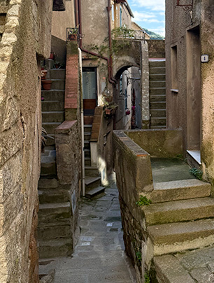
Home " Places of interest " 4-5 The Streets
🎧 Listen to the guide (Italian)
🎧 Listen to the guide (English)
🎧 Écoutez la guide (Français)
🎧 Escucha la guía (Español)
🎧 Hör dir die Führung an (Deutsch)
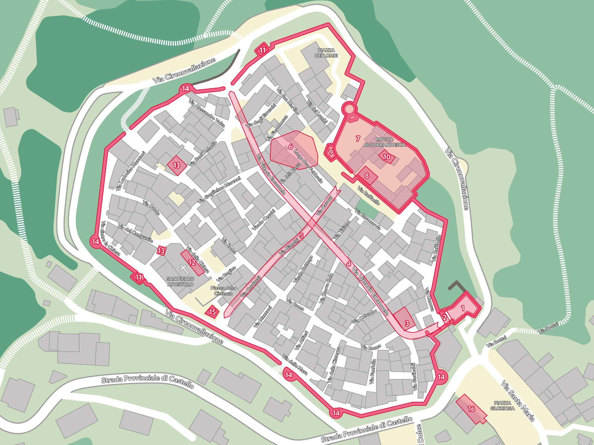
Regarding the road layout of the castle, one of the most interesting aspects that emerges from the historical sources is the arrangement of roads and routes.
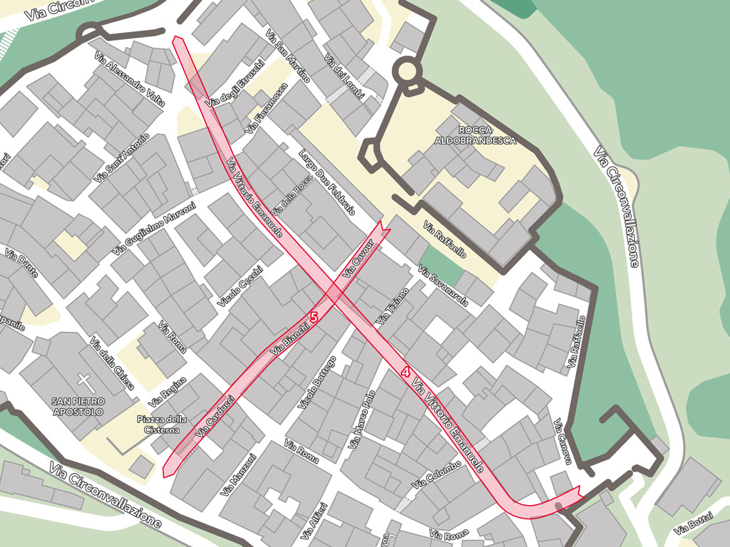
The cadastre of 1823 and 1835 provides a detailed representation of the road system, which, in part, follows the natural morphology of the hill on which the castle stands, thus adapting to its geographical and topographical characteristics.
However, despite this predisposition to the natural lay of the land, some roads show an arrangement that seeks a geometric regularity, a more rational layout that seems to respond to more complex organizational needs.

A feature of particular interest concerns the presence of two roads that intersected at right angles between the keep and the parish church.
This intersection is not accidental, but seems to suggest an urban layout that did not arise spontaneously, as a result of the simple organic growth of the village.
On the contrary, it appears to be the result of well-thought-out urban planning, which aimed to allocate specific spaces for specific functions within the castle.
This arrangement suggests that the area was organized rationally, with careful consideration of the social, civic, and religious functions of the place, as evidenced by the proximity of buildings of great historical and social importance.
One aspect that makes the analysis of this street layout even more fascinating is the fact that, unfortunately, it is not possible to determine with certainty whether this particular layout derived directly from the Medici reconstruction or whether, on the contrary, it was a reflection of earlier urban planning ideas.
The presence of some Romanesque buildings within the castle may suggest that the orientation of the streets derives from a design that dates back to an earlier period, and then was adapted or improved in the Medici period.
However, in the current state of knowledge, it is difficult to establish a definitive answer.
Despite uncertainties regarding the precise origins of this arrangement, the intersection of these two road axes might nonetheless suggest that, in the past, the castle had more than one access.
This fact may indicate that, in ancient times, there was a complex road network that allowed entry from different directions, facilitating connections with surrounding areas and other important defensive or administrative structures.
The fact that these axes intersected at a central point might also suggest a control and defense structure particularly designed to monitor access to the castle, a crucial element in ensuring the citadel's security.